road without service in North America.
255 miles without human facilities.
Along this stretch there is 187 miles of
exhausting unpaved washboard.
Finally, we reached the east coast of
Labrador. While the northern part was
covered by the boreal forest, this last
section had no sight of any trees. All the
time whipped by the frigorific North
Atlantic winds, the land was covered
with bogs and lichen of all the existing
green colors. We were crossing a naked
territory with exceptional vegetation
that we had never seen before.
We ate lunch on a high promontory
overlooking the village of Red Bay.
From 1530 to the early 17th century,
it was a major Basque whaling area.
There, several whaling shipwrecks
led to its designation as a UNESCO
World Heritage Site. (Google this!)
Then, by the end of the afternoon,
we boarded the ferry that brought us
from the continent to the "The Rock",
the gigantic island that makes up the
province of Newfoundland. For the
first time on our trip, rain started to
fall as we disembarked from the ferry.
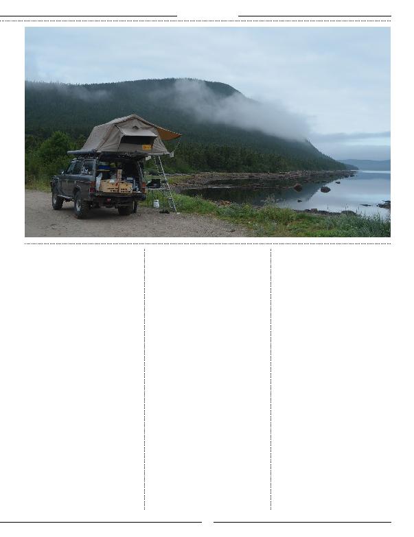
We took the long road to reach the
northernmost tip of the island where we
used a provincial campground and took
a restful hot shower.
We went on to visit a significant place
in history. The first known evidence
of European presence in America:
L'Anse aux Meadows. The fascinating
archaeological remains of a Viking
encampment, also a UNESCO World
Heritage Site (Google this!). This is
known to be the place representing the
first time human migration out of Africa
completed the circumnavigation of the
globe when Vikings met the Natives.
After visiting this historic location,
we headed south to admire the very
spectacular Gros Morne National Park.
Shaped by colliding continents and
glaciers, fjords and mountains tower
above a diverse panorama of bogs,
forests and barren cliffs, Gros Morne is
also a UNESCO World Heritage Site.
(Google this too!).
On our right, the very first part of the
park revealed itself as we drove along
the Gulf of St-Lawrence while the
cliffs and fjords stood to our left. Our
first stop was to visit Western Brook
Pond, a spectacular glacier-carved
land-locked fjord which we could see
from the road. But the weather was
not on our side. The clouds were low
and by the time we parked the Land
Cruiser and took the path to reach the
observatory, the visibility went from
almost passable to zero.
Then, we saw the seaside cliffs of Green
Point, a beautiful sequence of layered
rocks. Here, geologists discovered
fossils that defined the boundaries
between the Cambrian and Ordovician
periods and makes this specific place
on earth a world geological benchmark.
Been there, done that! Check another
one off the list.
Further on, were the Tablelands of Gros
Morne. This is a very rare place on earth
where you can see the Earth's inner soul:
the mantle; normally far below the crust.
Driving and exploring this unique place
was breathtaking. It was fascinating to
drive the road at the bottom of this glacier
path and to see a green vegetated side
and the mantle exposed side, a naked and
inhospitable orange soil with almost no
vegetation or life whatsoever. We went on
to trek for a few hours, enjoying looking
for carnivorous flowers and places fill our
bottles with crystalline water coming from
snow which remained timidly in August,
TOYOTA TRAILS
33