Apr 2018), this similar boreal forest
landscape was "déjà vu" for us. Still, it
is always pleasant to drive on a remote
road through the boreal forest while
crossing the 51st, 52nd and the 53rd
parallels. The more we drove the more
relief we felt.
On the road from Manic-5 to our
expected destination of the day,
Churchill Falls, we took a detour to run
through a former mining deposit site
which was easily accessible from the
road. The dark gray color of the rocky
debris filled with crystals glittering
in the sun gave us the impression of
traveling on a disco ball.
Aside from construction of the dam
in 1960, Route 389 has lately been
used to link the iron fields of northern
Quebec and Labrador. This is where,
far off on the horizon line among the
mountains, we saw an odd landscape
which turned out to be huge piles of
iron mining debris. At first, it was
intriguing because it seemed to be
mountains of another color, but as we
approached, we were shocked to realize
that the landscape had been literally
sacked by human activity. The mining
debris was literally the same height as
the surrounding mountains.
The last ten miles before entering
Labrador were extremely sinuous and
unpleasant to drive. Nothing is more
frustrating than turning and winding
constantly while, just beside the
road, we were following a perfectly
straight and parallel railroad
and electrical line.
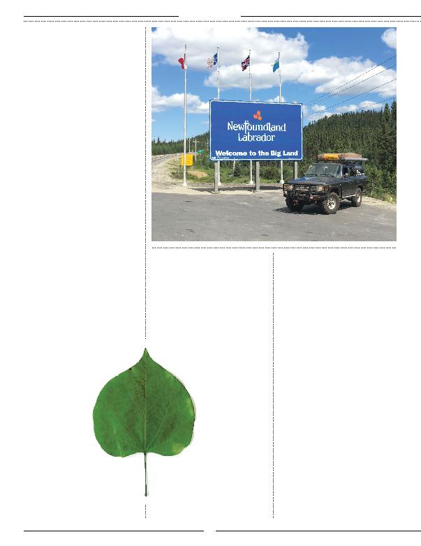
We found a paved road
that we had left 225
miles earlier to enter
Labrador. As the
tradition requires, we
stopped by the huge
blue "Newfoundland
Labrador Welcome
to the Big Land" sign to
immortalize this moment
on photo.
At this junction, the road took the
number 500 and became officially,
The Trans Labrador Hwy (TLH).
This road finds a privileged place
among a short list of remote roads
of the world that every overlander or
expedition lover should drive once
in their lifetime. Built in the early
1990's and previously unpaved and
hazardous, the first stretch of the
TLH to Churchill Falls, 160 miles,
was a real charm to drive.
This road traverses the vastness of the
boreal forest among the peat bogs and
the spruce trees. It is literally a pile
of gravel covered with asphalt that
stretches endlessly to the east.
The sun at its zenith was
with us, as were the trees,
flowers, lakes and rivers.
All the richness of
color of this place was
being infused in our
minds and memories.
At every moment, we
felt privileged. Despite
being on a road, we
were in a no man's land.
At the end of the afternoon, we
stopped to make a trek to admire what
was once one of the greatest water falls
on the eastern continent: Churchill
Fall. This previously majestic and
powerful roaring waterfall was now just
a faint trickle of water. Downstream,
the imposing Churchill River was
dammed to feed the world's second
largest underground hydroelectric power
plant. (Google this!) This allowed us to
appreciate all the work the water has
done on the bedrock that was released
from the glaciers thousands of years
ago. However, the most striking part of
this river diversion happened when we
crossed the bridge over the drained river
bed. This immense, but now dried-up
waterway makes us realize how human
construction can have unimaginable
consequences on nature.
Seeking a campsite for the night
brought us to park our Land Cruiser
directly on a dike near the water intake
of the hydroelectric power plant. It
was amazing to have the opportunity
to be on the top of this dike seeing,
in front of us, billions of cubic feet of
water being held back, and just 350 feet
below us, the forest stretching as far as
the eye can see.
Over the next two days, we covered
the last 565 miles to access the ferry to
Newfoundland. After Happy-Valley-
Goose-Bay, where Route 500 changes to
510, you will find the longest stretch of
Route 500
changes to 510,
you will find the
longest stretch of road
without service in
North America. 255
miles without human
facilities.
TOYOTA TRAILS
32